- 37 Posts
- 6 Comments

 0·7 days ago
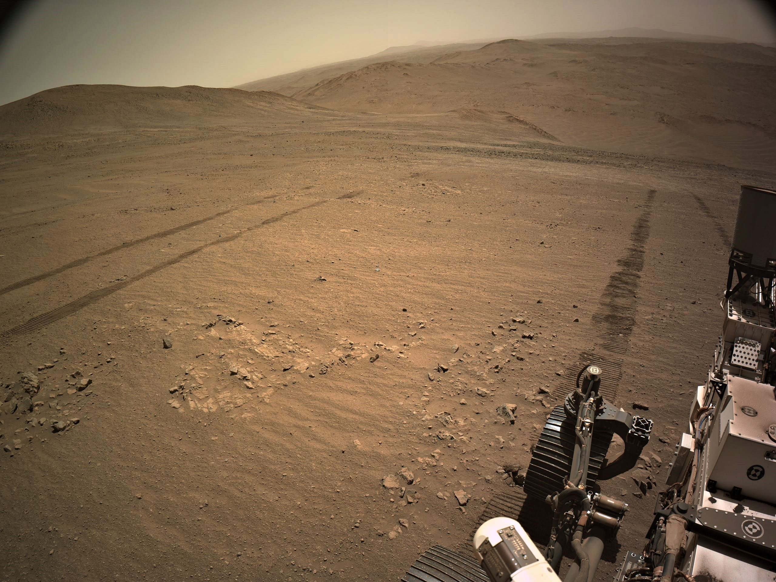
The folk at MSSS MastCam-Z team create and share 3D models featuring some of the sample sites and other points of interest, these are posted on SketchFab. So far they have posted 221 models, here’s the link to the MastCam-Z channel https://sketchfab.com/Mastcam-Z/models
I found the dossier documents I referred to in my last reply
Here is the link to the Planetary Data System (PDS) page that addresses the M2020 Sample Dossiers prepared and issued by JPL.
If you’ve not already read these treasure troves, I suspect you’ll need to assign a good few hours to digest their contents. The reports have been collated and updated throughout the last couple of years, but the PDS page has the versions available at this time, further collections will be added to the bundle at future dates and some bundles will be updated from time to time, so visit the page often if you find the reports interesting.
Note that the PDF’s in the 'Initial Reposts section are quite large. They do carry a warning: The Initial Reports are near-real-time records of activities surrounding sample acquisition, analogous to field notes. They are preliminary, and the interpretations and even some of the underlying measurements will be revised and described more fully in detailed follow-on publications.
LINK: https://pds-geosciences.wustl.edu/missions/mars2020/returned_sample_science.htm
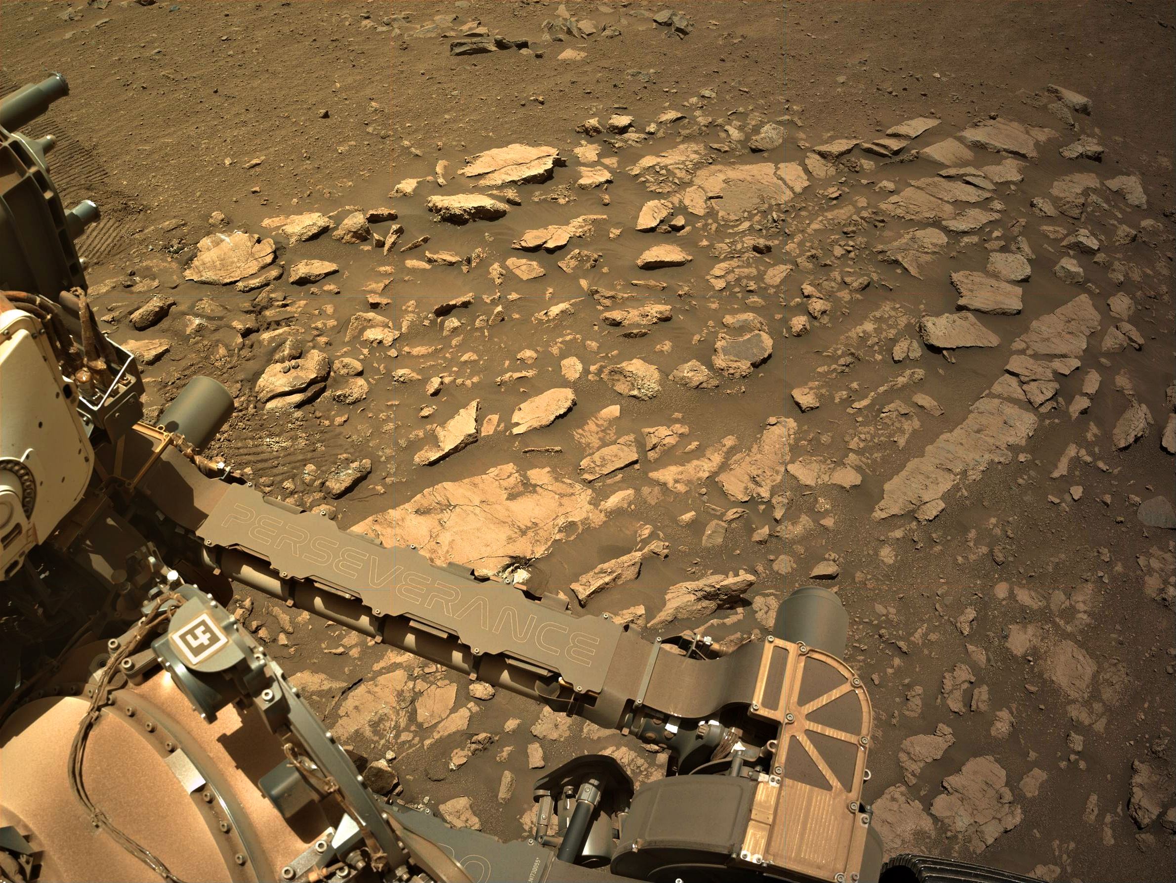
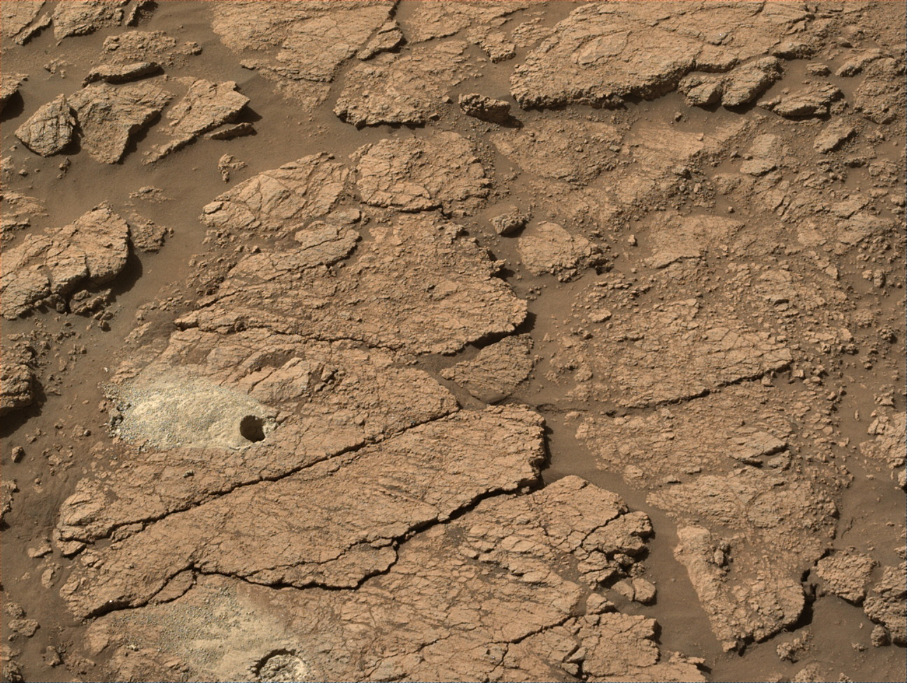
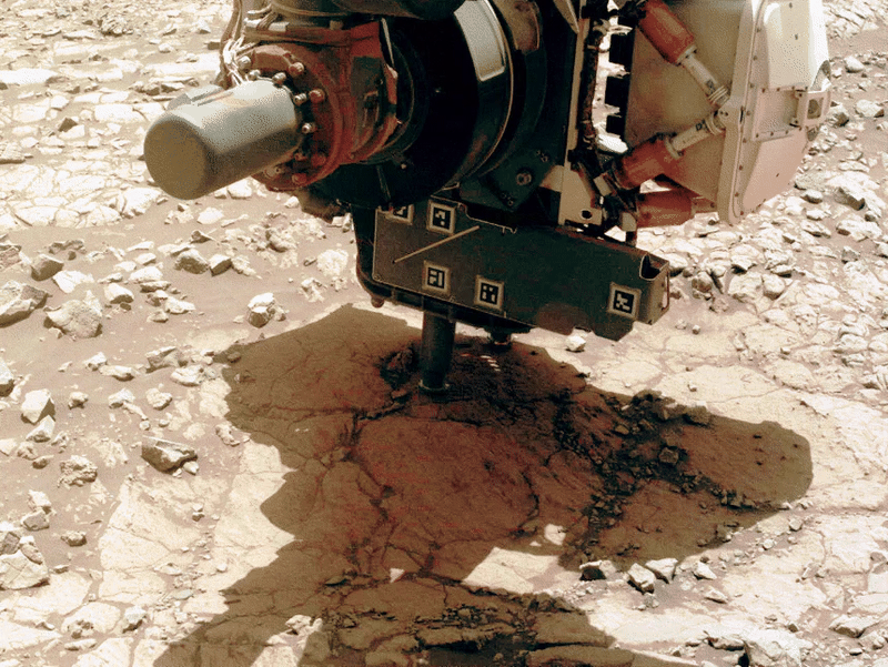
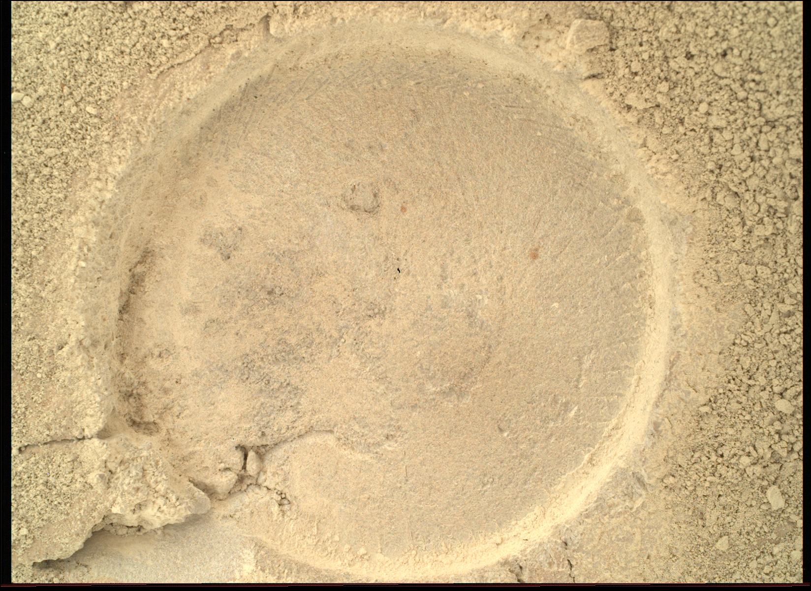
I realise that they call the images on the mission server ‘Raw’ but these are not raw images, but automatically processed images by JPL or ASU, and then placed on the server. All those images need to be properly calibrated before being used for science. Many of the green hues we see on these images are likely associated with the Bayer filter on the CCDs used in the colour cameras for the mars missions. The way it was explained to me is that they all use RGGB Bayer filters i.e. an array of red, green and blue sensors, but note that there are two letter “G’s” in the ‘RGGB’, this means the CCD has a grid composed of 50% green sensors, 25% red and 25% blue. This leads to an over saturation of green in most of the colour images. There may well be amounts of green materials (eg olivine) in some abrasion patches that are imaged using the white LEDs after sunset, but when you see the calibrated images in science papers etc there is far less green. I’ll see if I can find links to the PDF’s that show calibrated close ups of abraded patches :)
Agreed fully, definitely clearing skies. Such a pity we did not have those when the rover was sat on top of the rim still looking inside the crater. Maybe we’ll have better luck with clear skies in a few years when it heads back inside :)
I don’t believe there is any interpolation between frames. The entire sequence consists of 22 images acquired over a roughly 20 minute period. I believe the melting effect you’re referring to could the loose regolith dropping into the fractures between the plates. In addition the original was an MP4 file (see link in the post). This Lemmy instance does not support MP4 uploads so I had to convert it to a GIF, there could be some image artifacts from that conversion process, so try watching the original MP4 animation in the link :) Or check the original HazCam images on the mission image server.
We used to get get occasional post drive red/cyan 3D anaglyphs from JPL for MSL, but it looks like they got dropped when they redesigned their web pages as I can’t find them now.
As far as M2020 goes, converting the wide angle lenses of the NavCams will likely be hard? But in the next weeks I’ll have a go. In the past folk don’t appreciate the red/cyan anaglyphs, but that was in the days of Reddit, so if I can make any we’ll see how they go down :)